- THE PROJECT
- Urban development of Punta Zorroza
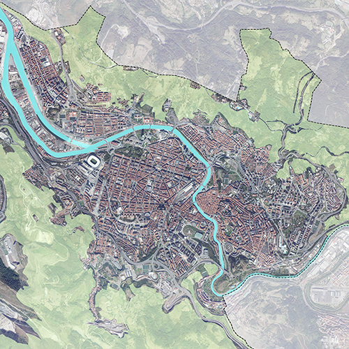
- LOCATION
- Bilbao
The LANDA BIZIA proposal by KREAN has won 2nd prize in the competition for projects with jury intervention, organised by the Bilbao City Council, for the development of the Punta Zorrotza area, by means of a modification of the Bilbao PGOU.
The KREAN proposal projects an innovative space to extend the Zorrotza neighbourhood and to articulate the relationship with other neighbourhoods in Bilbao, such as Elorrieta and Zorrotzaurre, and with the Burtzeña neighbourhood in Barakaldo.
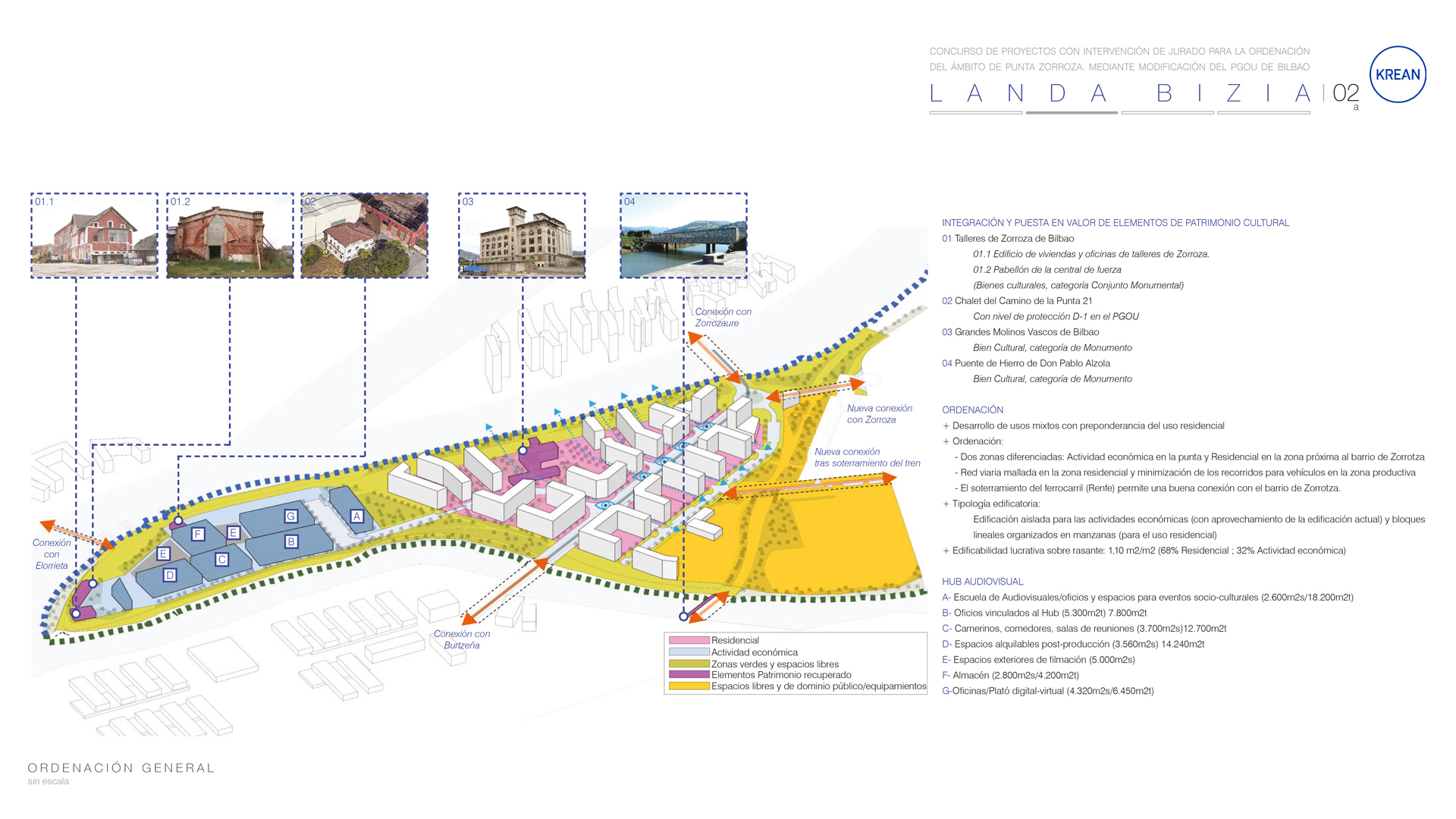
There are two main areas, the area closest to Zorrotza, with a predominantly residential use, and the area of La Punta, with economic activities:
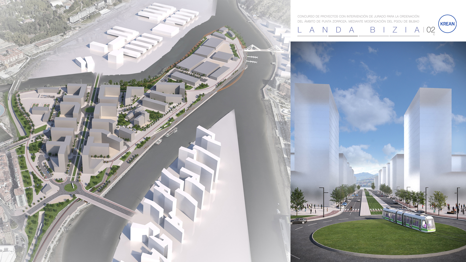
The residential area is arranged along an axis that links Zorrotzaurre with Burtzeña, with open residential blocks in a configuration that encourages the visual permeability of the coastal edge, generating visual axes of connection with the river landscapes that open up the city towards the estuary. This typology also permits the creation of numerous quality public spaces, which are scarce in Zorrotza.
On the border with Zorrotza, a large area for public use is planned. Taking advantage of the land freed up by the burying of the railway, a large park (the railway park) is being developed in which the new railway station is situated and which extends to the Kadagua, and where an educational facility is to be located, as well as some public housing.
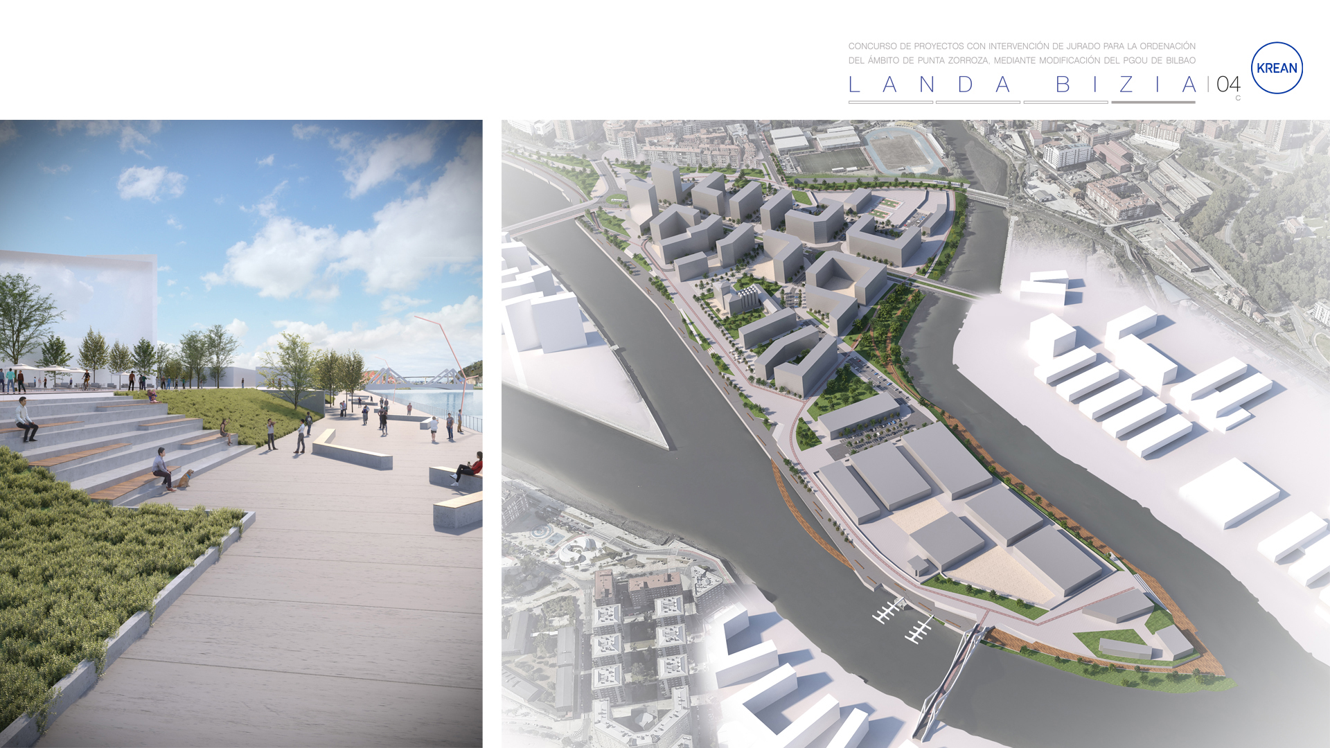
The residential grid, with building capacity to accommodate around 2000 dwellings, is extended towards the front of La Ría, integrating and enhancing the value of the Molinos Vascos building, around which a public space is arranged as a central square of the new development. It is proposed to refurbish the building of great heritage value as a building for tertiary use, with a view to transforming it into a hotel, student residence, co-living, or another type of temporary residence.
The economic activity zone of the point includes a large private area for the development of an audiovisual hub with the possibility of locating up to 6 buildings, including the existing ones, in which the building known as "Chalet de la Punta" is also integrated, and several spaces for outdoor filming are arranged.
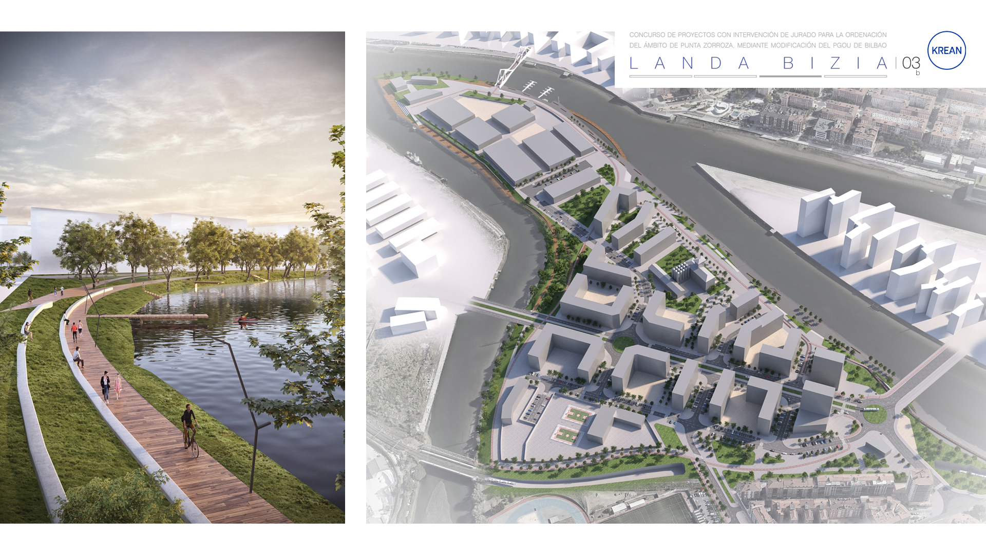
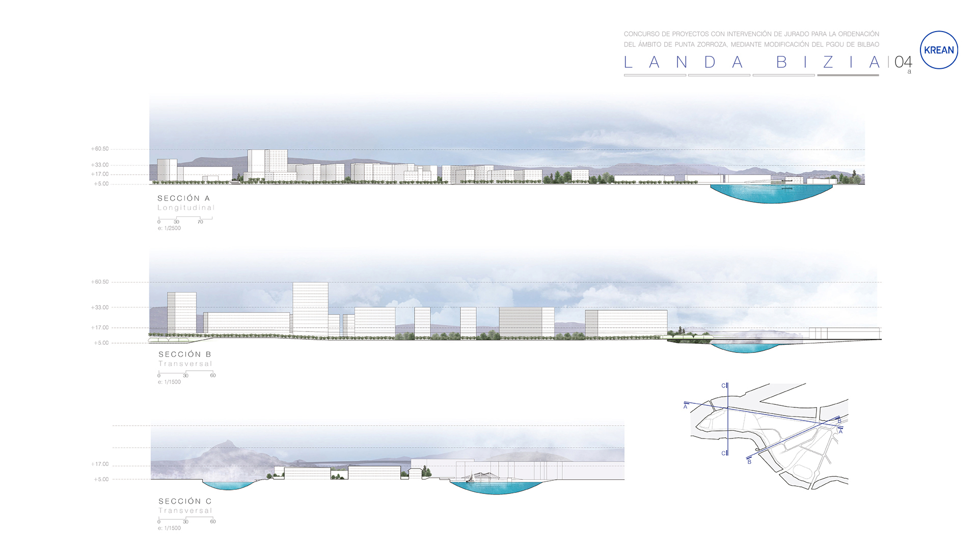
The layout of the buildings ensures a complete riverside promenade on both banks, especially on the Kadagua.
Outside the private space of the audiovisual hub, at the northern end, a tertiary area is planned to house commercial and leisure spaces in which the "Talleres de Zorroza" buildings are integrated. At the southern end of the hub, a building is planned for private educational/socio-cultural facilities for the development of training in the audiovisual field and related trades, which could include spaces for exhibitions, congresses and shows.
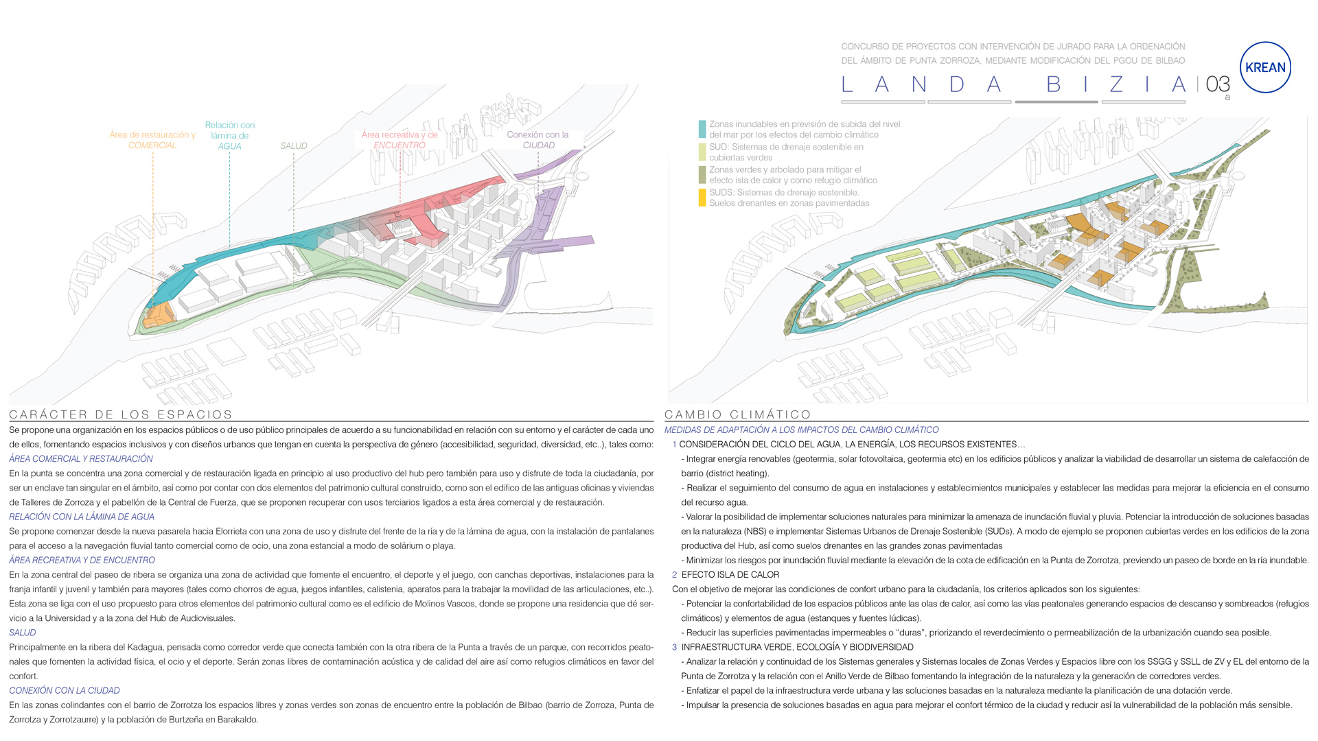
In terms of open spaces, the proposed development has numerous spaces of different types, among which the following are worthy of note:
- On the one hand, we have the entire riverside with a more urban character towards the estuary, and with a more natural character towards the Kadagua.
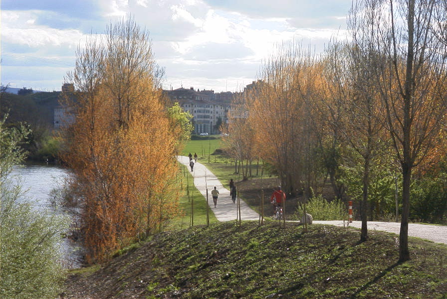
- On the other hand, there is the "railway park" with large recreational areas and pedestrian and cycle paths.
- At the access from Clara Campoamor street, a large boulevard is laid out that crosses the entire residential area up to the estuary, forming a large square next to the Molinos Vascos building.
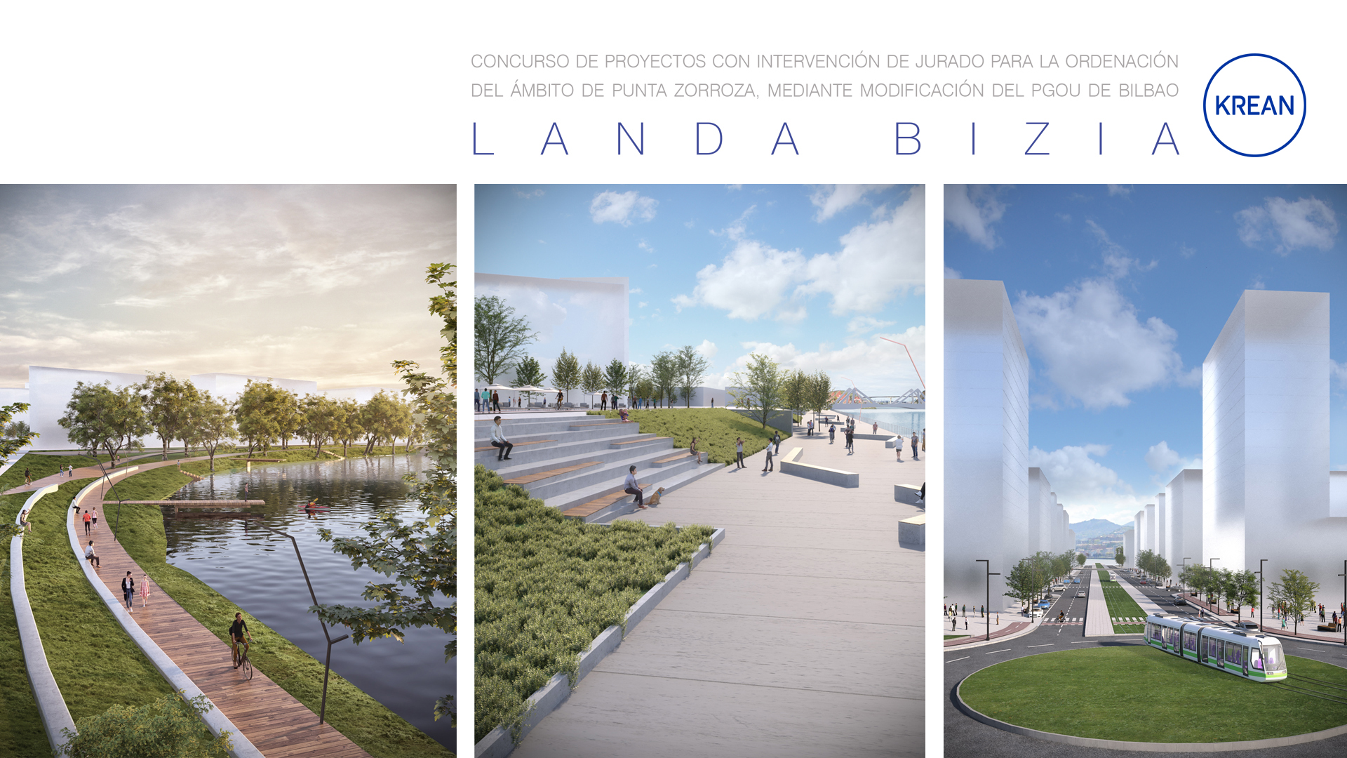
The riverside, both in the area of the estuary and in the Kadagua area, becomes a large public space that allows Zorrotza to be opened up to the water for its enjoyment, generating leisure and recreational elements in continuity with the proposed itineraries and corridors. The design of the riverside takes into account the prevention of flooding caused by climate change by creating flood zones in times of flooding and protection zones.
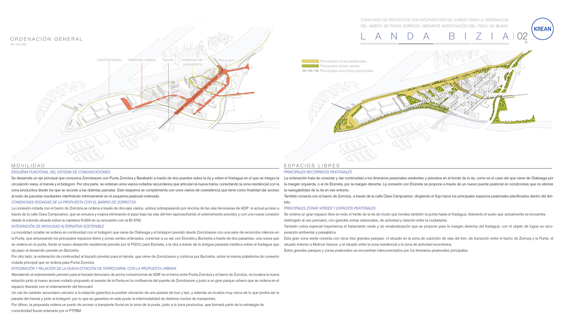
The functional scheme of the communications system is organised along several communications axes.
- A main axis is laid out (via the PTP metropolitan promenade), which connects Zorrotzaurre and Burtzeña by means of the two bridges approved by the plans of both municipalities, which incorporates the tramway infrastructure and roadways for road and pedestrian traffic.
- Access from Zorrotza is via two streets. One of them is the current Calle Clara Campoamor, the gradient of which is modified to access the area over the railway line that is being buried. The other is a new street from the roundabout at the junction of the N-634 and the BI-3742 that will connect with the roundabout at the start of the bridge to Zorrotzaurre.
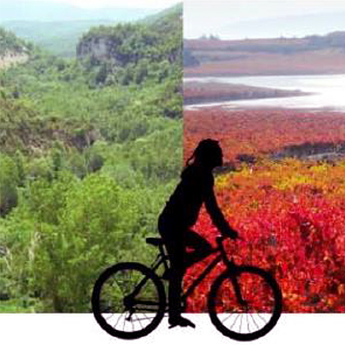
- In addition to motorised transport links, non-motorised mobility is guaranteed by a network of bidegorri which: links Zorrotza with Olabeaga by means of the promenade on the banks of the river; links Zorrotza with Burtzeña by means of the Alzola bridge over the river Kadagua; links Zorrotza with Elorrieta by means of a mobile footbridge over the river in the area of La Punta. The network of cycle paths is also arranged along the whole of the coastline connecting the free spaces and parks along the estuary, along the banks of the Kadagua and in the new park planned for the railway.
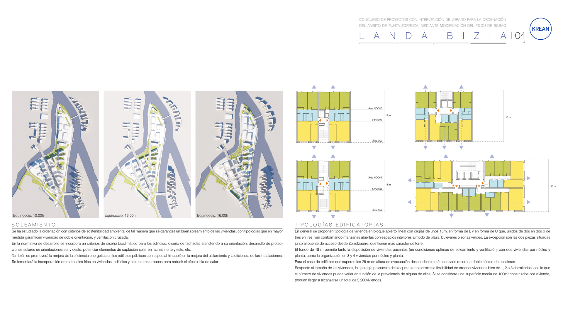
With regard to sustainability and climate change, the proposal takes into account the implementation of measures to adapt to the impacts of climate change, such as, in this case, the rise in sea level, river flooding and the heat island effect. It is proposed to raise the height of the building at the Punta de Zorrotza (+6), providing a promenade along the estuary (+5) in order to minimise the risks in the event of a rise in sea level and the overflowing of the estuary by limiting the area that can be flooded in a controlled manner. To minimise the heat wave effect, large green areas have been arranged with leafy trees and shaded rest areas (climatic refuges) and water features (ponds and playful fountains) have been created in the pedestrian areas (promenades and squares). On the other hand, the proposal establishes criteria to implement nature-based solutions by prioritising the development of Green Zones and Sustainable Urban Drainage Systems (SUDS), such as green roofs on the buildings in the productive area of the Hub as well as draining soils in the paved areas.
From a bioclimatic point of view, the planning has been studied in such a way that all the dwellings are guaranteed good sunlight, with typologies that to a greater extent guarantee double orientation and cross ventilation. This planning can be developed through regulations that incorporate bioclimatic design criteria in the buildings and the resulting open spaces (design of façades according to orientation, development of solar protection in south and west orientations, promoting solar capture elements on the north and east façades, etc.). The improvement of energy efficiency in public buildings will also be promoted, with special emphasis on improving insulation and the efficiency of installations.

Projects