- THE PROJECT
- Special Urban Development Plan for plot Z.5.1 Arcelor area
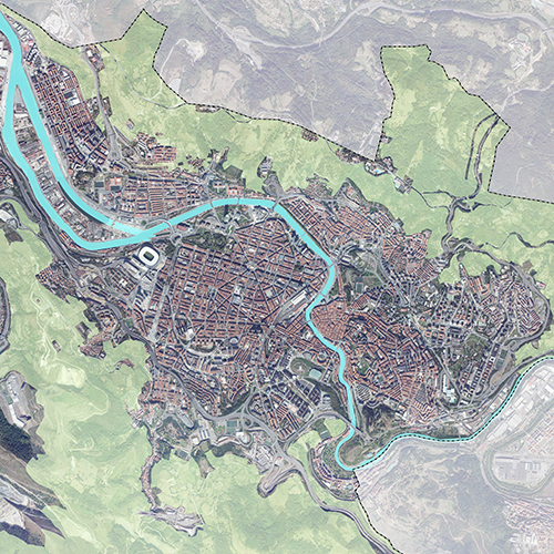
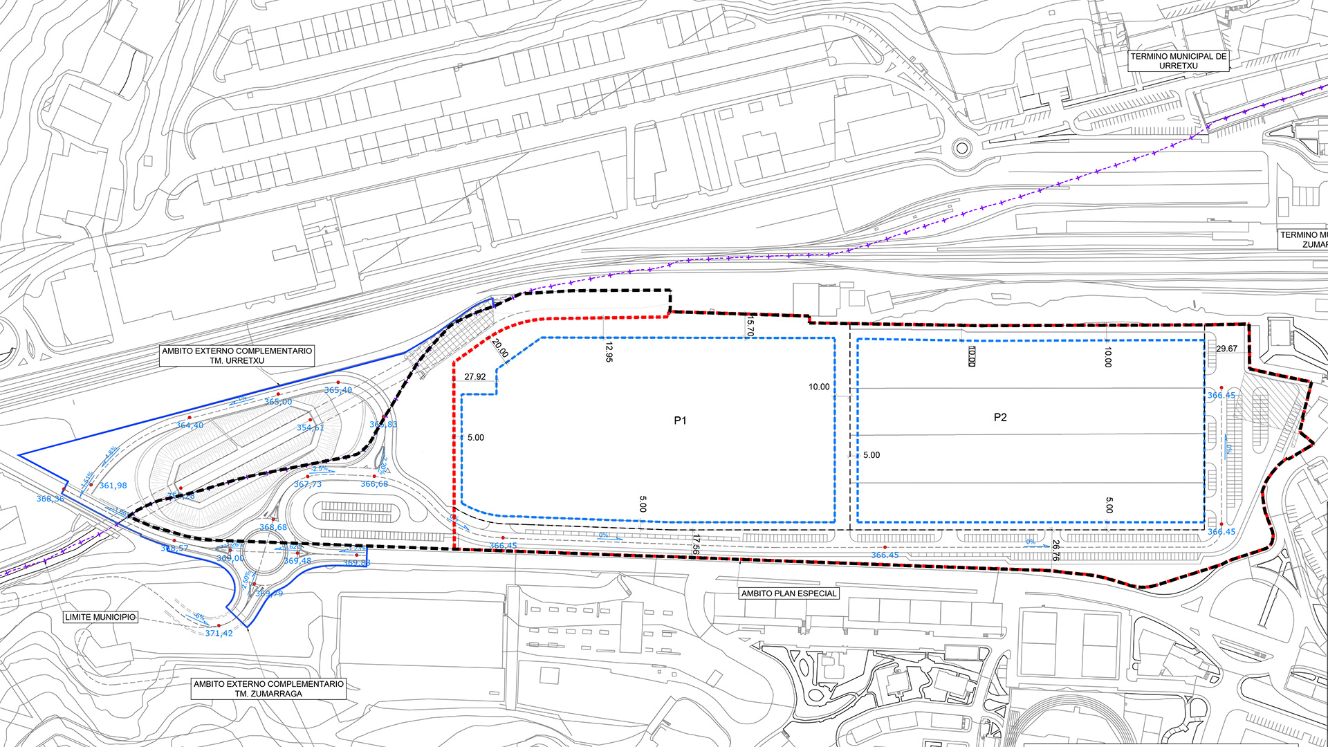
- LOCATION
- Zumarraga, Gipuzkoa
Sprilur, part of the Basque Government's Department of Economic Development, Sustainability and Environment, is acquiring the land of the Arcelor Mittal company in Zumarraga in 2021, with the aim of regenerating it and promoting the creation of new substitute industrial activities that will generate new employment. This project is part of a Strategic Plan of Extraordinary Investments that SPRILUR is carrying out, among others, with a view to prioritising the rehabilitation and regeneration of industrial spaces and business areas in disuse over the coming years in the Basque Autonomous Community.
To this end, a Special Urban Development Plan was drawn up with three fundamental objectives in mind:
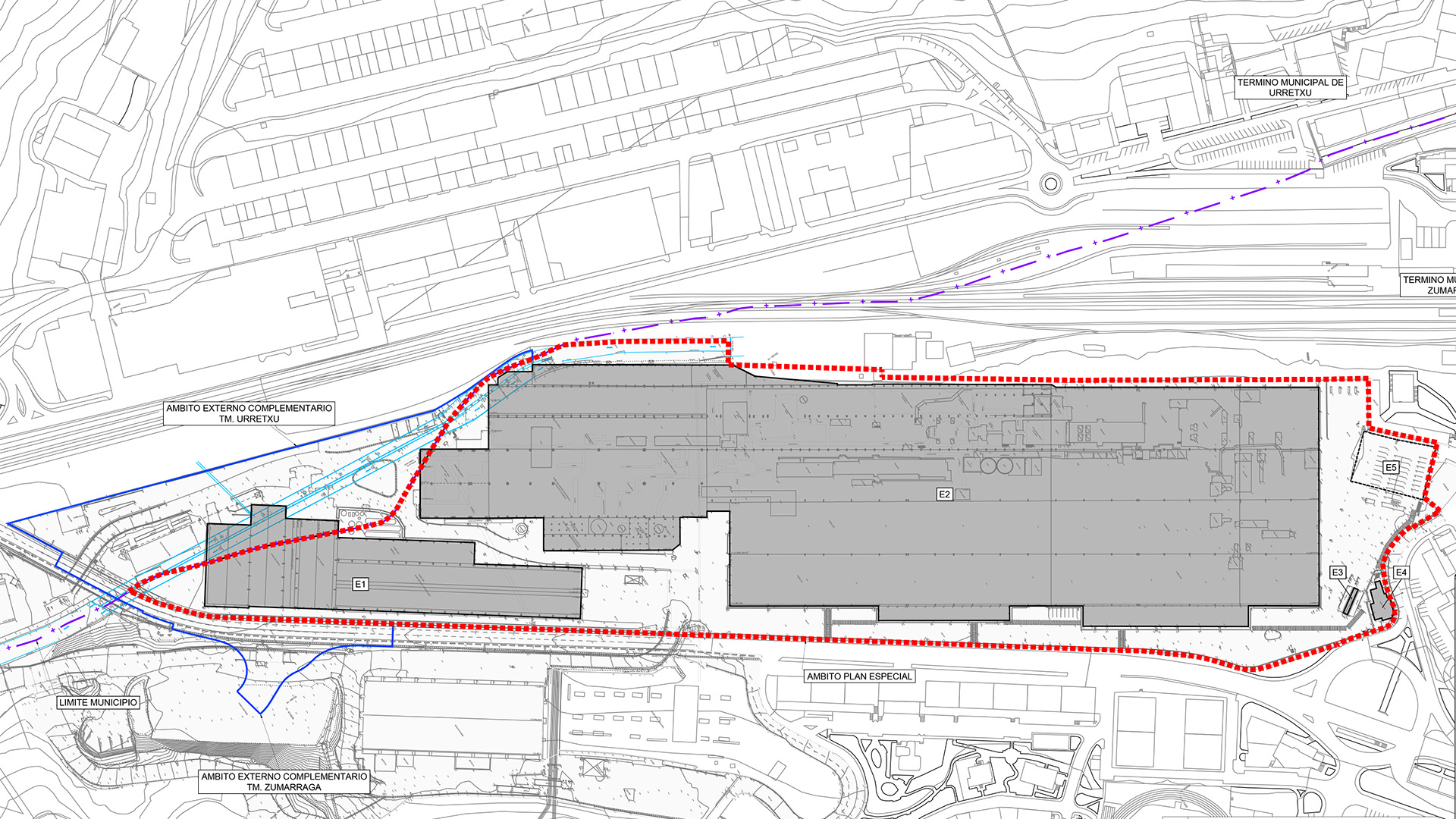
- Redevelopment of the Z5.1 Aceria1 area, regenerating the current facilities, maintaining their industrial use and facilitating the location of new economic promotion activities.
- Provision of a new access from the GI-2632 road to replace the current one, moving industrial mobility to a point with a suitable scale and resolving access to other nearby industrial areas.
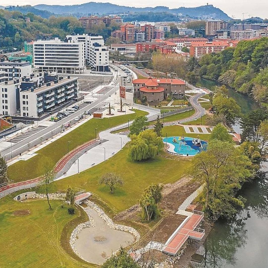
- Discovery of the river Urola on its south-eastern boundary and generation of new public spaces around the river.
In order to improve the accessibility of the area and its integration into the urban fabric of Zumárraga, it is necessary to carry out complementary urban development works on land which, in part, is outside the scope of the Special Plan.
Two external complementary areas are defined: one in the Municipal District of Urretxu and the other in the Municipal District of Zumárraga. These works are necessary for the discovery of the Urola river and for the definition of the new access to the Arcelor site, which also serves as access to the Zumárraga industrial area located to the east of the GI-2632, in the Kaminpe industrial area located in Urretxu and in Legazpi.
Given the complexity of the execution of the shared urbanisation, an Urban Planning Collaboration Agreement has been signed between the three municipalities involved to facilitate the traceability and urban planning processing of the Special Plan and the related Projects.
The area of the Special Plan is 99,851m².
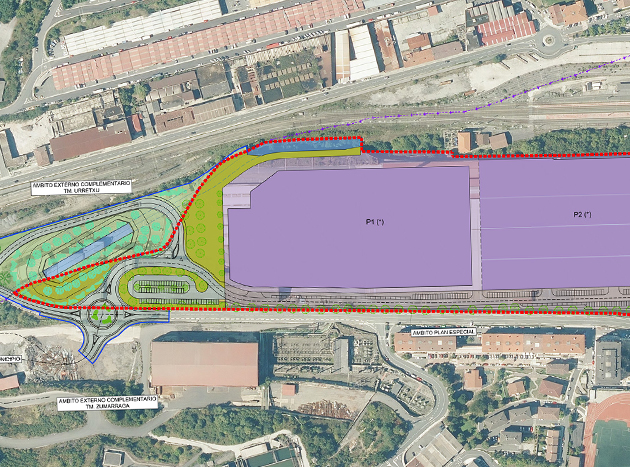
The proposed new development includes the construction of a new access roundabout at the southern end of the area, the uncovering of a 100m long stretch of the river Urola, around which a green area of more than 8,000m2 will be laid out, restoring the environment and creating a riverside promenade. In addition, a new public parking area will be created with a capacity of 68 parking spaces.
In order to carry out these actions, it is necessary to demolish part of the building. The rest of the buildings could be maintained or replaced with the same buildability.
Projects